


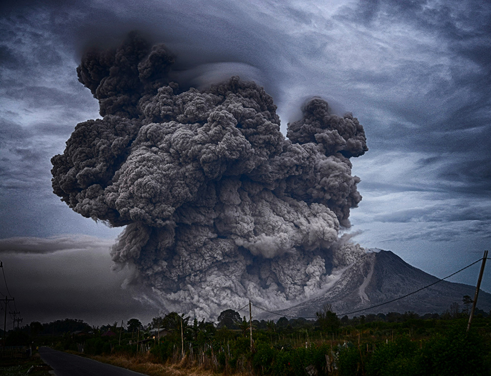
Natural disasters are occurring more frequently, disrupting lives and economies worldwide. With these events becoming harder to predict, reliable climate data has never been more essential. Advanced analysis of weather patterns, historical trends, and environmental changes provides valuable insights that can save lives. Dr. Philippe Smith discusses how data shapes predictions, so communities and leaders can better prepare for what’s ahead.
Understanding Climate Data
Accurate natural disaster prediction relies on analyzing climate data, which records Earth’s atmospheric and environmental conditions over time. This data helps experts identify potential disaster warning signs by revealing key environmental trends.
Climate data is grouped into categories reflecting significant environmental factors. Temperature records track daily highs and lows, seasonal averages, and long-term shifts, providing insight into trends like heat waves or ice melting, which can lead to flooding. Precipitation data, including rainfall and snow measurements, assess the risks of storms and droughts. Analyzing changes in these patterns helps predict floods, landslides, or water scarcity. Atmospheric pressure data highlights shifts in weather systems; low-pressure areas often indicate storms, while high-pressure areas may signal dry conditions, aiding in hurricane forecasts.
Reliable predictions draw from a variety of data sources.
“Advances in technology and research have enhanced data collection methods, boosting accuracy and relevance,” says Dr. Philippe Smith. “Satellites orbit Earth and provide real-time insights into temperature, cloud cover, and atmospheric composition, offering a global view for tracking large-scale weather systems.”
Ground-based weather stations monitor local conditions such as temperature, rainfall, and wind speed, providing consistent information for specific areas. Climate models use historical and current data to simulate future conditions, predicting long-term trends like rising sea levels and increased storm activity.
Each source contributes a unique perspective, combining to form a strong framework for accurate forecasting and disaster readiness.
The Relationship Between Climate Data and Natural Disasters
Climate data is key for understanding, predicting, and mitigating natural disasters. Analyzing environmental patterns helps scientists identify warning signs of potential events. Reliable data supports accurate predictions of when disasters might happen and their severity. Each type of disaster—hurricanes, floods, or droughts—depends on specific climate information for effective forecasting and preparation.
Hurricanes and severe storms are among the most damaging natural events. Climate data allows meteorologists to track their development in detail. Indicators such as ocean surface temperatures, wind speeds, and atmospheric pressure are used to forecast storm strength and path. Warmer sea temperatures contribute to hurricane formation, while shifts in wind patterns signal potential intensification.
Notes Dr. Smith, “Modeling these factors using real-time and historical data provides forecasts days in advance, allowing communities time to evacuate or prepare resources.”
Flooding can strike with little warning without accurate climate data. Rainfall measurements, soil moisture levels, and river flow rates help predict flood risks. Saturated soil is more prone to flooding after heavy rain. Analyzing precipitation and comparing it to past flood data helps estimate when and where flooding may occur. This information aids water management systems and urban planning, guiding decisions like opening floodgates or reinforcing vulnerable areas. Climate data also supports early warning systems that alert communities in at-risk zones.
Droughts often develop gradually, impacting agriculture and water supplies over time. Climate data helps identify early signs, such as declining rainfall trends. Temperature data is significant, as higher temperatures increase evaporation rates and reduce water availability. Remote sensing and weather stations offer insights into soil moisture, lake and reservoir levels, and vegetation health. This supports preparations for water shortages or crop failures. Early drought predictions help allocate water and food resources more efficiently, reducing economic losses.
Challenges in Using Climate Data
Climate data plays an important role in disaster prediction, but various challenges impact its effectiveness. From accuracy to accessibility, these issues hinder forecasting and planning.
Achieving accurate data is difficult due to measurement errors, outdated equipment, and inconsistent collection methods, which can compromise data quality. Inaccurate satellite readings and flawed weather station data can lead to unreliable forecasts and delayed responses.
Climate patterns involve numerous variables, making complete datasets challenging to create. Gaps in historical records or missing real-time data impede trend identification. Even minor inaccuracies can accumulate, affecting climate model outcomes and the prediction of events such as hurricanes and floods.
Access to high-quality climate data varies, with developing regions often lacking resources for advanced weather monitoring. This creates data gaps and limits understanding in some areas.
Data availability can also be restricted by proprietary systems or privacy concerns. Organizations that charge for data access or limit sharing create obstacles for smaller institutions and local governments, affecting disaster preparedness.
Processing and analyzing climate data requires advanced technology, which can slow progress. High-performance computing systems, needed for climate models, are costly and energy-intensive. Budget constraints may prevent organizations from keeping pace with technology.
Data storage and integration are additional challenges. Decades of climate data require substantial storage and secure management. Outdated systems can struggle with large data volumes, reducing usability for analysis and decision-making.
These challenges demonstrate the complexity of using climate data effectively. Addressing them requires collaboration among governments, researchers, and private organizations to support reliable predictions and informed action.
The Future of Climate Data in Disaster Prediction
The role of climate data in disaster prediction continues to expand with technological advancements. New tools and systems improve the collection, analysis, and use of environmental information, leading to more precise forecasts and better resource management. Focused on technological progress, climate science is becoming increasingly accurate.
Satellites are at the forefront of modern climate data collection. Recent advancements have increased resolution and measurement detail, allowing for more frequent and accurate monitoring of the atmosphere, oceans, and land surfaces. Hyperspectral imaging sensors detect changes in temperature, vegetation, and ocean currents, providing insights into conditions that signal severe weather, such as warming sea surfaces.
“Real-time data transmission also speeds up response times to weather changes,” says Dr. Smith.
The impact of improved satellite technology extends to better tracking of storms and cyclones and monitoring hard-to-reach regions, such as remote oceans and dense forests. Enhanced coverage results in more comprehensive climate data, helping to fill gaps in forecasting models.
Big data and artificial intelligence (AI) have transformed how climate data is processed. Complex weather patterns involving multiple variables, like temperature, humidity, and wind, are analyzed by big data systems, identifying trends beyond human capability. Machine learning, a subset of AI, adapts dynamically to new data, making it more effective than traditional models in recognizing early disaster warning signs.
AI-driven models provide detailed storm path forecasts days in advance and analyze past droughts to help manage water usage in future dry periods; this integration of big data and AI results in more actionable forecasts, allowing for earlier warnings and better preparedness. As technology continues to evolve, disaster prediction will grow even more precise.
Climate data forms the basis for natural disaster prediction, turning uncertainty into actionable knowledge. Enhancing data accuracy and accessibility helps communities receive timely forecasts. With ongoing improvements, the potential for precise predictions will expand, making disaster preparedness stronger. Governments, scientists, and organizations must invest in advanced tools and cooperative efforts to foster a future of informed, safe decision-making.